
The Library of Celsus is the photograph many visitors carry home from Ephesus. To understand how the city worked, though, look beyond a single facade. Think about movement: where people and goods arrived, how they crossed the city, and where buying and selling took place. Ephesus was a port city in the Roman period, but its shoreline has changed so much that the water is no longer beside the ruins. Reading the surviving streets and market in relation to that vanished harbour gives the site a different shape.
Start with the landscape, not a trade legend
Ephesus developed in the former estuary of the Kaystros River. The UNESCO World Heritage description explains that sediment gradually shifted the coastline westward. Settlements and harbour areas changed location as a result. What looks like an inland archaeological site today was once connected to maritime routes. The important point is not to imagine one unchanging city beside one permanent quay. Its geography and built environment evolved together.
UNESCO calls the ancient city an outstanding example of a Roman port city and identifies a sea channel and harbour basin. Its World Heritage account also connects Ephesus with the wider Artemis sanctuary, the later Christian sites around Selcuk, and an urban landscape built over many periods. Those facts support the idea of a city connected to travel and exchange. They do not, by themselves, establish a precise list of goods, an exact annual trade volume, or a simple label such as "the Silk Road capital." Those details need their own evidence. A visitor can gain much more by asking what the surviving places actually show.
Arcadian Street: a route through the city
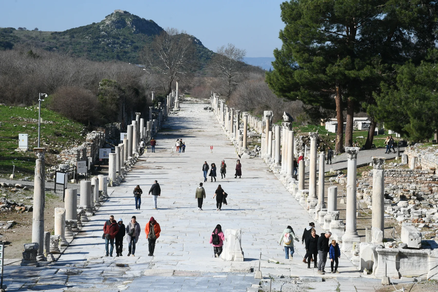
Arcadian Street, also known as Harbour Street, is a useful starting point. The official Ephesus visitor map labels it "Arkadiane / Harbour Street" and places it in the same broad area as the Great Theatre and the former harbour. The street's surviving columns and paving make it easy to see as a grand entrance, yet its practical role matters too. It helped connect an arrival area with the public life of the city.
Standing along the street, notice its width and long sightline. A visitor moving through ancient Ephesus encountered more than isolated monuments. Streets organized approach, direction and procession; they also let people move between different kinds of work and gathering. The arrangement visible today is a product of centuries of building, repair, excavation and conservation. It should not be treated as a frozen snapshot of one particular day in Roman history.
The Commercial Agora: where exchange had a place
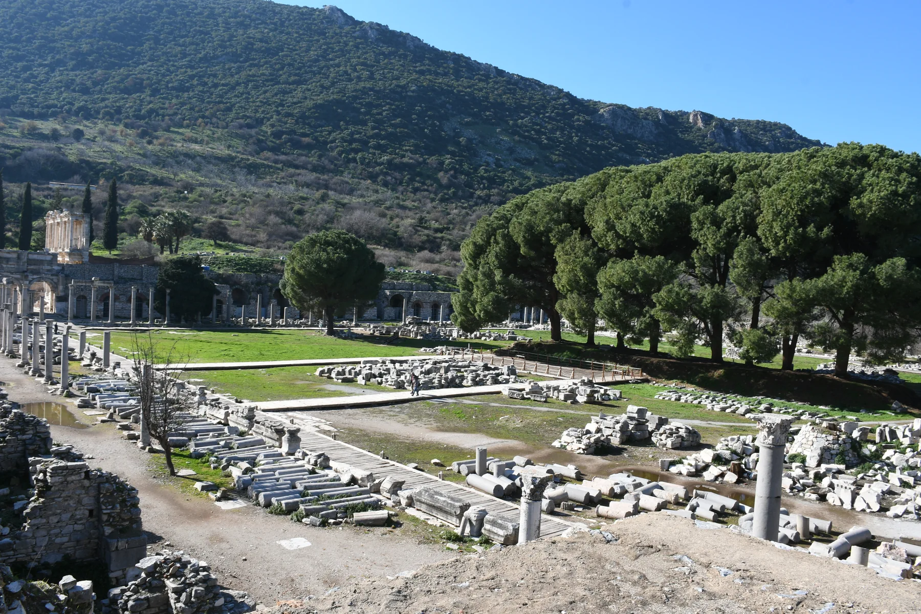
The official site map names the Tetragonos Agora as the Commercial Market. Its position in the city helps make an abstract word such as "economy" concrete. There was a designated urban space for exchange rather than commerce being an invisible activity behind the famous buildings. The surviving outline and architectural fragments suggest the scale of this planned public setting, although they cannot tell us everything once bought and sold there.
Look at the open area and the lines of the surrounding structures. They invite questions: how did someone enter the space, where could a seller stand, and how did market activity relate to movement through nearby streets? Archaeology can identify a market setting, but a modern visitor should distinguish the physical evidence from a reconstructed scene of individual transactions. That distinction is part of what makes Ephesus interesting. The ruins are not a ready-made film set; they are evidence to be interpreted carefully.
Why the harbour moved away
The distance between the present ruins and the sea often surprises first-time visitors. UNESCO identifies sedimentation as a central reason for the changing shoreline and the relocation of harbour areas. The river carried material into the estuary over time, making access to the water a continuing challenge. This was not a single dramatic event that simply ended the city overnight. The history of Ephesus includes successive settlements, harbours and later communities in the Selcuk area.
Keeping that long timeline in mind avoids two common mistakes. First, the modern coastline should not be projected unchanged onto a Roman map. Second, the visible monuments should not all be assigned to one moment. The city developed, adapted and changed. A guide can help place a building or street within that changing landscape, but even without one, the official map and World Heritage description provide a reliable framework.
What can you actually see on a visit?
A practical route can connect the Harbour Street, the Commercial Agora and better-known landmarks such as the Great Theatre and the Library of Celsus. The order depends on the entrance used, current access rules and the time available. It is better to choose a few questions to carry through the site than to race past every labelled monument. Where did people arrive? Which spaces were designed for public gathering or exchange? Which parts of the former harbour landscape are no longer obvious to the eye?
Underfoot conditions matter. Ephesus includes uneven ancient surfaces and exposed areas. Comfortable footwear and time for a slower walk make the urban layout easier to appreciate. If you are visiting from a cruise ship, leave room for the transfer and the agreed return to port rather than assuming the full site can be covered at any pace. Current admission, opening hours and accessible routes should be checked with the official museum service shortly before travel.
Our private Ephesus shore excursion from Kusadasi can frame the city's streets and monuments around your confirmed port window. The exact meeting point, route and return plan are set out in the written offer. Site admission is not included in the published starting price. For background on tickets, see the Ephesus admission guide.
The city is more than one famous image
Ephesus rewards visitors who connect its spaces. The former harbour explains why a major city stood here. Harbour Street explains how movement could be channelled into the urban centre. The Commercial Agora shows that trade had an architectural place in daily life. None of these stops supplies a complete account of every worker or merchant, but together they offer a grounded way to imagine a working city without turning uncertain details into facts.
Sources and further reading
Explore Ephesus with context.
Review the route and inclusions before requesting your own private itinerary.
EXPLORE THE KUSADASI EPHESUS TOUR