
Pamukkale is often the first name visitors learn in the Denizli region. Yet the Lycus Valley also holds Laodikeia, an ancient city where a long colonnaded avenue gives the ruins a strong sense of direction. Syria Street is a useful place to begin: its surviving paving and columns invite you to think about movement, commerce and repeated rebuilding. Laodikeia is a separate archaeological site from Hierapolis-Pamukkale, so a visit here deserves its own time and planning.
Locate Syria Street within Laodikeia
The Denizli Provincial Directorate of Culture and Tourism places Laodikeia north of modern Denizli, in the Lycus Valley. UNESCO's description of the archaeological site, currently on Türkiye's Tentative List, identifies Syria Street among its monumental colonnaded streets. This is not the same designation as the inscribed Hierapolis-Pamukkale World Heritage property. Keeping those two statuses distinct helps you understand both the geography and the heritage labels you may see in travel descriptions.
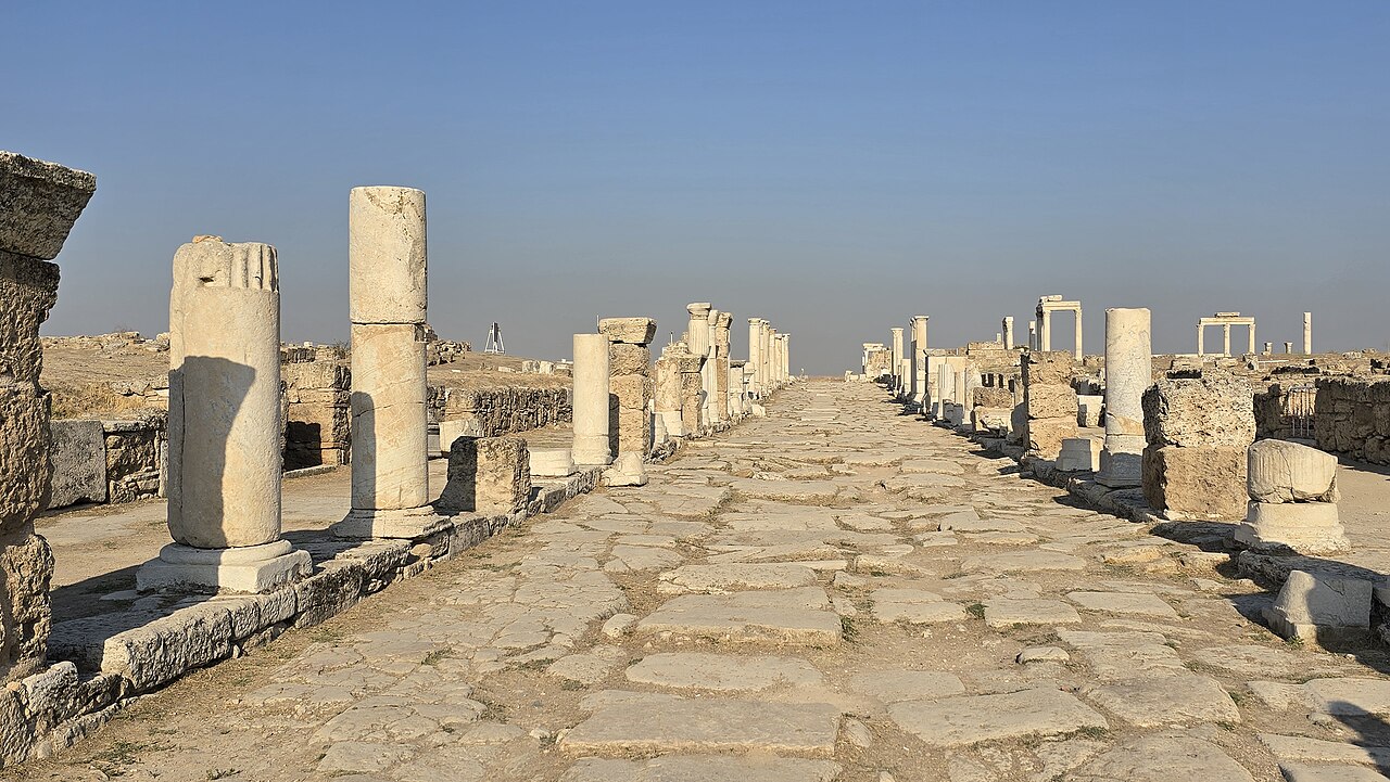
Begin with an official site plan or the signs at the entrance. Find the main street before choosing individual monuments. A broad line of paving and columns makes it easier to place nearby spaces in relation to one another. Look toward the far end of the avenue, then turn back and notice how the street frames views across the plateau. The photographs below show the actual site; they are not reconstructions of how every building looked in antiquity.
Read a street shaped by more than one period
UNESCO describes Laodikeia as a city founded in the Hellenistic period that grew especially prominent under Roman rule. It lists two theatres, baths, agoras, fountains, churches and several streets within a large urban site. Syria Street belonged to this connected city, not to an isolated collection of picturesque columns. Imagine people using the avenue to reach markets, civic buildings and religious spaces at different moments in the city's long life.
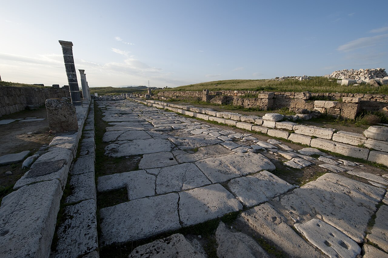
The surfaces visible today do not all belong to one date. Earthquakes, repair, later building and modern conservation changed the streetscape. When a column stands upright beside a fallen fragment, do not assume that the whole line survives exactly as it did in Roman times. Ask which pieces were found in place and which were reset during restoration. That simple question makes a walk more informative and avoids treating a carefully presented archaeological landscape as an untouched ancient street.
There is another useful question: what happened beneath the paving? A street had to carry people and goods, but an ancient city also needed drainage and water distribution. UNESCO's inventory includes substantial water infrastructure at Laodikeia. You may not be able to see every channel or identify every phase from the visitor path. Look at the paving, edges and nearby building entrances, then use the on-site explanation to connect visible details to the larger system rather than guessing from one photograph.
Notice how the avenue connects other places
UNESCO lists the Syria Gate, Temple A and several public spaces in the site's urban inventory. A plan can show which of them lie near the street and how the walking route connects them today. The avenue is therefore a practical orientation tool as well as an archaeological subject. Instead of rushing to a single landmark, pause at an intersection and ask where a person arriving from outside the city might have gone next.
Laodikeia also has a religious history that extends beyond its classical buildings. The Denizli tourism authority notes its connection to one of the seven churches named in Revelation. Our guide to the Seven Churches of Revelation gives the wider regional context. The ancient congregation and the remains visible on Syria Street are related chapters of the city's history, but a modern visitor should not identify an arbitrary wall as the church mentioned in the text.
Plan a visit that gives the site room
Laodikeia is an open archaeological landscape, so expect exposed areas and uneven ground. Wear shoes suited to stone and gravel, carry water and sun protection, and leave time to read the signs instead of measuring the stop only by the length of a photograph. A broad view is useful at first; details become clearer when you slow down and compare a surviving column with the street and the adjacent building line.
Check the official Denizli visitor-information page shortly before travelling for current access, opening arrangements and any conservation restrictions. Do not rely on an old article for a ticket price or assume every path will be open. Follow marked routes and keep behind barriers even when a tempting camera angle lies beyond them.
If your main day is at Hierapolis, compare the urban stories rather than collapsing the two sites into one. Frontinus Street at Hierapolis offers another way to read a monumental approach, while Syria Street belongs to Laodikeia. A private Pamukkale and Hierapolis tour on this website covers its published route; Laodikeia is not an included stop. If you want to visit both places, ask for a separate written itinerary and allow the team to check travel time, access and the available day before making plans.
Finish by looking back along the avenue. The view is memorable, but its deeper value is in the questions it raises: how a city organized movement, adapted after damage and kept using a familiar route while the buildings around it changed. Syria Street makes Laodikeia easier to read as a lived city in the Lycus Valley, not simply as a scenic detour from Pamukkale.
Sources and further reading
Explore Denizli / Laodikeia with context.
Review the route and inclusions before requesting your own private itinerary.
EXPLORE THE SEPARATE PAMUKKALE TOUR